“…Victory was slowly receding from the Nile.
‘Let’s take one last look,’ said the doctor, ‘at this impenetrable geographical expanse, which even the bravest travelers have never been able to overcome. Here are precisely those tribes mentioned by Petherick, d’Arnaud, Miani, and that young traveler, Lejean, to whom we owe the best works on the Upper Nile.”
Jules Verne, Five Weeks in a Balloon
Guillaume Lejean, a 19th-century Breton cartographer, embarked on several significant expeditions driven by a profound interest in geography. After receiving an imperial commission to explore the sources of the Nile in 1860, he shifted his focus to the relatively unexplored European region of Turkey, later known as the Balkans. In 1856, Lejean proposed an ambitious project to the French Ministry of Public Education, aiming to map the area from the Black Sea to the Adriatic. His plan sought to provide detailed information on the region’s physical geography, geology, ethnography, and communication routes. Lejean put particular emphasis on exploring the region inhabited by the Albanians of Kelmend, viewing it as key to understanding the geographical, physical, and ethnographic characteristics of the area. He also recognized the historical importance of the routes connecting Lake Shkodër to Lake Ohrid and the Vardar basin.
The French government assigned Lejean six missions across the Balkans, although his comprehensive project remained unfinished due to his untimely death and the subsequent loss of many of his cartographic works. His surviving writings, compiled in Voyages in the Balkans (1857–1870), document his visits to Northern Albania in 1858 and 1869. Influenced by ancient geographers, Lejean recognized the continued use of Roman roads in the region. Although he was fluent in Latin and Greek, his lack of proficiency in local languages and Turkish forced him to rely on interpreters, often French consuls stationed in Shkodër. His observations, captured in both scientific and more accessible styles, highlight his skill as a storyteller—adept at portraying characters, conveying the hardships of travel, and vividly describing the landscapes. These writings provide a rich foundation for understanding his itineraries through Albania.
Let us now follow Lejean’s routes as outlined in his accounts of northern Albania.
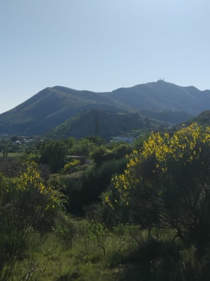
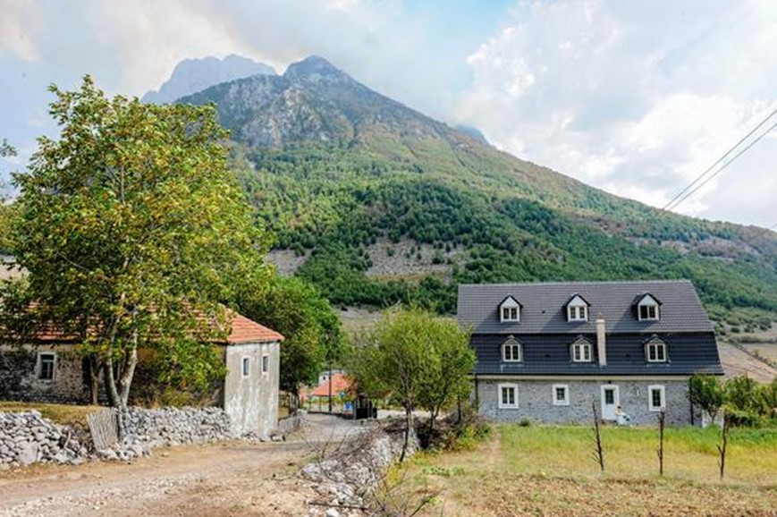
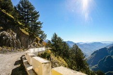
Shkodër, The View of the Lake and the Valley
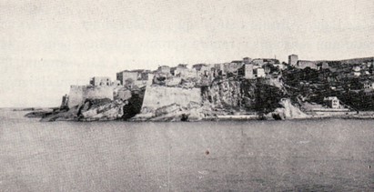
The itinerary we follow in Northern Albania corresponds to Lejean’s second journey to the Balkans, undertaken between August and September 1858. Due to the turbulent political situation in the region, the scope of this expedition was limited to Croatia, Albania, Montenegro, and Bosnia-Herzegovina. Lejean departed from Dubrovnik (Ragusa) on a Lloyd steamer bound for Bar (Antivari) and then proceeded eastward into the mountainous territories inhabited by autonomous tribes. He followed the ancient road to his destination, Shkodër, whose final segment following the course of the Buna River (Bojana), which was partially navigable. Nevertheless, “opposite the village of Obot [Hoboti], there was a sandbank where the water was never more than three meters deep, almost completely obstructing navigation.” Lejean’s first encounter with Shkodër was marked by a sense of dignity: “we saw a solitary hill rising before us, crowned with a large Venetian fortress. I recognized it immediately, despite never having seen it before. It was the idyllic Rozafa, the historic fortress of Shkodër,” at the foot of which he crossed the commercial center known as Pazari.
The following morning, accompanied by Mr. Robert, we ascended the Hill, a striking vantage point that allowed me to survey the entire area at a single glance …
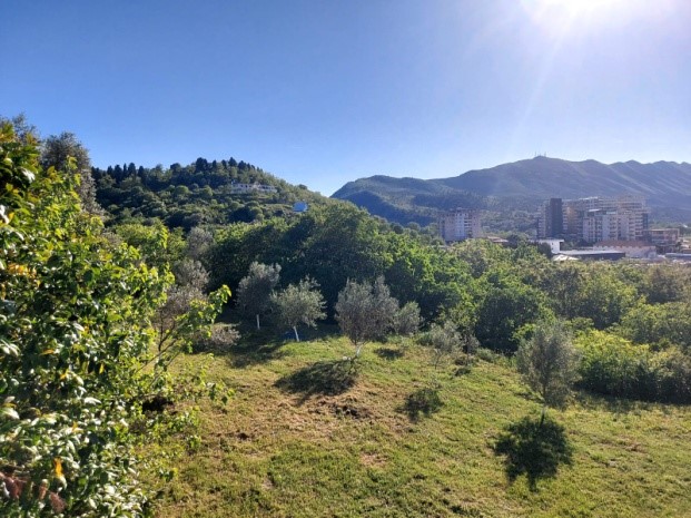
Kodra e Tepes (foto Fatjona Troshani)
The author’s description serves as a valuable resource for contemporary tourist guides, providing a rich blend of visual observations and sensory impressions that can deepen visitors’ appreciation of the site. As it was perceived by the 19th-century traveler, the Hill (referring to Tepe Hill) continues to offer a remarkable panoramic view today, capturing key elements of interest to observers, scholars, and writers alike.
Lejean’s description firmly establishes the Hill as a destination that visitors must see, primarily for the breathtaking views it provides.
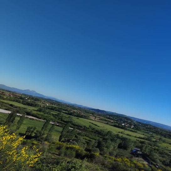
“Around us stretches a plain approximately 27 leagues long and of varying width, generally following the course of the Morača River, the lake, and the Buna River as they flow toward the sea. The peaks of the Hill and Rozafa form a small chain of isolated schistous heights within this plain. Looking northeast, one enjoys a beautiful view of the lake tapering into a cone shape toward Montenegro, whose towering mountains drift in the morning mist. To the right, a nearer and therefore more distinct mountain range reveals its forested slopes, home to the pastoral and semi-autonomous tribes known as the Seven Bajraqe. Mount Cukali, the southernmost of these peaks, exposes a deep cleft through which the Drin River flows, separating it from the rugged and shadowed massif of Mirdita.”
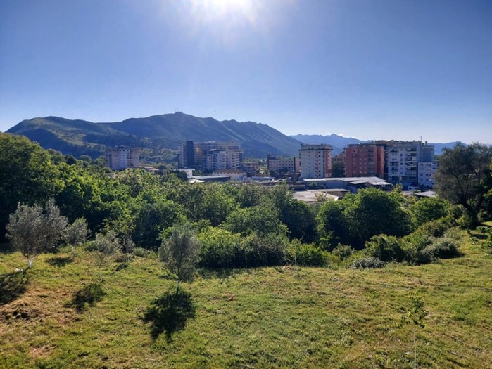
Taraboshi dhe rrafshina verilindore parë nga Tepe
(foto Fatjona Troshani)
Essentially, this description is more than just a panoramic view. It serves as a gateway to a rich history and culture intricately tied to the natural landscape. A well-crafted tourist guide could effectively draw on this description to enrich the visitor’s experience. The expansive plain, stretching 27 leagues, evokes a profound sense of space and grandeur. A guide can highlight both its geographical significance and its economic relevance to the region.
The Morača River, Lake Shkodër, and the Buna River are natural features that Lejean weaves into a single, cohesive panorama. A well-prepared guide can provide detailed information about each of them, including potential activities such as boating, fishing, and birdwatching, as well as their ecological and historical significance.
Kalaja e Rozafës e parë nga kodra e Tepes (foto Fatjona Troshani)
The lake, known as Blato by the Slavs and Liqeni by the Albanians, stretches out like a calm mirror, bordered to the west by a gray ridge whose final hills reveal rocky promontories and a few fishing villages. To the east, the plain inhabited by the communities of Buza e Ujit and Hoti ends in such a gentle slope that it is difficult to distinguish where land ends and water begins—the terrain turns into arable fields in summer and marshland in winter. Here, one encounters ancient lakeside traditions reminiscent of those found in Ancient Greece and modern Celtic regions. Local inhabitants say the lake was not always this large, and that on its eastern shore there once extended a plain dotted with villages, known as Fusha e Proneve. Following an earthquake that damaged the area, the plain was submerged, and elders claim that when the water is calm, one can still see the ruins of houses and the tops of trees beneath the surface.
The isolated peaks of the Hill and Rozafa, described by the author as a “small chain,” can serve as the basis for an itinerary that links the two, emphasizing both their contrast and interconnection. A guide can delve into the historical significance of the Rozafa Fortress and the strategic importance of the Hill as a panoramic observation point.
“While studying the beautiful plain known as the Spahis’ Plain, which stretches from the river to the foot of the hill that served as my observatory, I saw a muddy river beginning at a bend in the Drin and flowing into the Kir, which in turn emptied into the lake, right near the fishing grounds.”
The view towards Montenegro. This can be a highlight for visitors, especially on a clear day. The sensation of “morning” and “morning mist” creates a particular atmosphere. The tourist guide may suggest visiting the Hill in the early morning hours to experience the same feeling.
The forested mountain range, described as “closer and therefore more visible,” can encourage visitors to explore the area, with suggestions for hiking, visits to mountain villages, or other natural attractions. The mention of geographical landmarks, such as “Mount Cukali, the southernmost of these peaks,” positions it as a useful reference point, aiding in orientation. The phrase “It lets you see the deep cleft where the Drin flows” highlights a key visual element. The
Kiri dhe Fusha e Spahinjve e parë nga Tepe (foto Fatjona Troshani)
guide can emphasize the view of the Drin Gorge, the significance of the river, and perhaps suggest boat trips or visits to panoramic viewpoints offering sweeping river vistas. The description “Which separates from the fragmented and gloomy massif of Mirdita” introduces a contrast between the landscapes. This distinction can be explored further in the guide, highlighting the rugged terrain and unique history of Mirdita, as well as the geographical and cultural differences between the two areas.
A thematic itinerary could be developed around the mentioned locations. For example, a section of the guide might focus on exploring the Seven Bajraks area, combining visits to historically significant villages, nature walks, and opportunities for interactions with local inhabitants.
The traveler’s path.
One can trace the steps of the traveler by visiting the locations that left a lasting impression on Lejean’s memory.
The Vraka River: “[..] a clear and beautiful stream, this valley so green and so flat from afar, …where the beds of the streams we encounter along the way offer us only their ripples of dazzling white sand [..].” Lejean’s description of the river can be paired with insights into its ecological significance and potential activities for visitors in the surrounding area. The comparison to the Albanian “Crau,” drawing parallels with the French Crau (a region where the Durance and Rhône rivers converge in Provence), helps convey the unique blend of arid and green landscape characteristic of the valley.
Përroi i Thatë (The Dry Stream)
Bjeshkët e Namuna (foto Nënshati)
As we headed towards the most beautiful rock formations, we arrived at the edge of a magnificent abyss, four feet wide and six to eight leagues long:
“[..] It was one of those beautiful terrors that make tourists quickly forget all the hardships they have endured. We thought
we were on a chalk plateau, covered by four fingers of vegetable earth and a veritable shower of stones, but it
turned out to be a gully—one you only notice when you are right on the edge. It stretched into the mountains to the east, reaching the foot of the notorious Bjeshkët e Namuna mountain. The dry riverbed, [..] a strip of white sand winding through the dense foliage of trees lining the ravine walls, their tops reaching up in a brilliant green [..]. The disappointment felt by the traveler is palpable. The general features of the landscape had led him to expect a beautiful river with clear water flowing beneath those trees, yet, leaning over the abyss, he saw only small sand dunes and blocks of rock, washed down by the water at the bottom. This realization made the harshness and dryness of the landscape all the more apparent. This was the famous stream, Përroi i Thatë, with which I would become intimately familiar, as I would have to follow it all the way to Bogë.
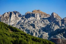
The phenomenon of the Përroi i Thatë, which flows only once or twice every decade—typically following exceptional rainfall in the Bjeshkët e Namuna—presents a mystery that would intrigue both tourists and scholars with an interest in geology.
Dedaj (foto Nënshati)
Equally noteworthy is the Dedaj Valley, an offshoot of the Përroi i Thatë valley, which is known for its potential fossil deposits. Lejean, following Mr. Viksent’s guidance, hoped to identify a genuine fossil quarry in the area. However, his inability to speak Albanian led him to miss this opportunity, which, as he noted, might have been revealed to him by local villagers: “the lack of knowledge of the Albanian language made me lose this godsend, which perhaps the villagers would have shown me.” This reference to the fossils in the region offers an opportunity to attract visitors with a specific interest in geology and paleontology.
Bërzela , Hidden Oases
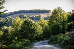
As night fell, a cirque gradually unfolded before us, formed by two or three ravines that converged into the stream. Every winter, impetuous torrents, driven by storms and melting snow, surged through the ravines. The waters, easily absorbed by the porous calcareous soil, accumulated in this natural hollow, where the humus swept down from the mountain slopes contributed to the fertile soil. This increased fertility is evident in the unusual abundance of agricultural crops, fruit trees, pomegranates, and wild grapes that thrive in the valley.At the end of the cirque, the white houses of the village of Bërzela (Bzhetë) are scattered, marking the center of the clan, and thus it is referred to as Shkrel on most maps. The Bërzela valley offers an unparalleled view, particularly in May, when the nearby peaks are still covered with snow. The contrast between the dark foliage of the forests that clothe the steep slopes, the pristine white of the surrounding peaks, and the vibrant green of the valley’s awakening vegetation creates a truly breathtaking scene.
Boga (foto Nënshati)
The landscape of Bogë, much like that of Bërzela, lies within the bed of a former lake, which has since dried up due to the diminished flow of the Përroi i Thatë. The valley displays a striking sequence of horizontal layers, indicative of successive periods of drought. The village is dispersed along the right bank of the valley, while a solitary church stands on the opposite side. The depiction of Bogë as the former bed of a desiccated lake, with its visible horizontal stratigraphy, presents an intriguing site for those with an interest in both natural relaxation
and geological exploration. The contrast between the expansive plain of Shkodër, the forested mountainous regions, and the fertile, cultivated valleys further highlights the region’s diverse and dynamic landscape.
The portrayal of the pastoral and semi-independent tribes provides a valuable foundation for a historical itinerary, offering opportunities to explore their history, traditions, and social structures. Such an itinerary could include visits to regions historically linked to these tribes. The account of the Gjakmarrja (blood feud) phenomenon in Pulaj and Nikaj, although complex, offers significant insight into the social realities of the period. Similarly, the description of syncretic religious practices in Koplik, where Muslims show devotion to Saint Nicholas and Saint George, serves as a compelling illustration of religious syncretism in the region. Furthermore, the depiction of hospitality in Zagorë underscores one of the key traditional values of Albanian culture. The story of Çuka, a shepherd from Shkrel who speaks Italian and acts as Lejean’s interpreter, exemplifies the integration of highlanders into broader socio-cultural networks, highlighting the region’s connections with the outside world and the adaptability of its people.
“A race of muscles and iron hearts,” Lejean calls them, emphasizing the strength, independence, and resilience of the mountain population. The image of shepherds, even young ones, with rifles, indicates a culture where weapons were part of daily life. This can be explained in the historical context of the time. The typology of the Gheg highlanders, their description as tall, slender, and with proud faces, illustrates the physical and cultural differences between the inhabitants of mountainous areas and those of cities.
What struck me most from the outset was the ancient essence that pervaded the highlanders. I encountered a people whose way of life seemed scarcely altered since the era of Herodotus. Their customs appeared to have remained unchanged since the times of Seuthes or Hersobleptes, evoking a deep sense of continuity with antiquity. Even the proper names, which abound in their communities, serve to reinforce this impression. Many of these names are rooted in pagan traditions. Among the men, one encounters the brave warriors named Bibë and Lepuri, while the women bear names such as Kuqja, Bjeshka, Lula, and Prena, names that evoke a vivid sense of place and culture, rich in both history and symbolism.
The captivating passages excerpted from Lejean’s text serve as valuable illustrations of local culture and history, offering a lens through which to examine both changes and continuities over time. By comparing these historical accounts with the present-day reality, they highlight the evolution of traditions and societal dynamics in the region.
The 1869 Journeys
Grabom (foto Nënshati)
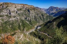
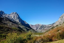
I began my topographical explorations with Shkodër as the focal point and initiated a preliminary excursion to the northwest. My journey commenced along the lake towards Kastrat, and from there, I proceeded towards Hot. I ascended the deeply eroded Cem Valley, reaching Grabom, and followed the valley further, climbing toward the watershed of Perdeleci. From this point, I descended into the Gernçari Valley, which led me to Guci. After approximately an hour, I reached the summit of the plateau marked on maps as Prokleti (Bjeshkët e Namuna).
Qafa e Bordolecit (foto Nënsahati)
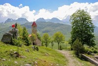
From the southern edge of the plateau, which descends sharply into the Shala Valley, I traversed a daunting path to Okol, the central settlement of the upper Shala Valley. The following day, I navigated a winding trail towards Soresi (Qafa e Thores), and after a descent lasting two hours, I arrived at Bogë. I crossed the mountain via a long gorge known as Përroi i Thatë, which guided me to the plain near Zagorë, from where I returned to Shkodër via Koplik.
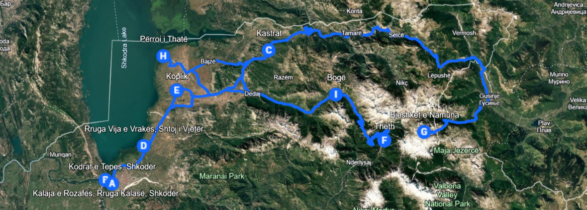
Using this text as a framework, a tourist guide can create a comprehensive and engaging experience for visitors keen to explore Shkodër and the Albanian Alps. Beginning and concluding the journey in Shkodër, as Lejean did, offers a natural flow. The author’s itinerary (Shkodër – road along Shkodër Lake – Kastrat – Hot – Cem Valley – Grabom – Perdeleci – Gernçari Valley – Guci – Bjeshkët e Namuna – Okol – Sores (Qafa e Thores) – Bogë – Përroi i Thatë – Zagorë – Koplik – Shkodër) provides a solid foundation for an organized tour or can be adapted as a recommendation for more adventurous travelers. This route emphasizes the remarkable geographical and natural diversity of the region, encompassing lakes, deep valleys, narrow gorges, mountain plateaus, and expansive plains.
Shtegu i Okolit (foto Nënshati)
The description of the Cem Valley as “deep and eroded” can encourage visitors to explore this valley and learn about its geological formation. The division of waters at Perdeleci sparks curiosity about this hydrologically important area. The inclusion of “Prokleti” (Bjeshkët e Namuna), this evocatively named plateau, in the itinerary underscores the dramatic nature of the landscape and invites visits (with warnings about challenging terrain). “The terrifying path to Okol”, is a detail that can attract adventurous travelers and emphasize the isolated character of the Shala Valley.
The itinerary not only invites visitors to appreciate the natural wonders of the region but also provides ample opportunities for adrenaline pumping activities, including hiking and mountain climbing, such as valley ascents, zigzagging trail climbs, and descents from the plateau. Exploring the valleys, particularly Cem and Shala, offers opportunities to discover local villages and immerse oneself in the region’s culture. Additionally, visits to villages such as Grabom, Guci, Okol, Bogë, Zagorë, and Koplik serve as key stopping points, providing travelers with the chance to experience authentic local life and hospitality.
Qafë Thore (foto Nënshati)
The guide draws upon the experience of an early traveler, providing a historical perspective on the region. The comparison between the landscapes and travel conditions described by the author and those of the present-day highlights both changes and continuities. A map tracing the author’s route could serve as a useful visual element. For each location mentioned, the guide can offer supplementary information on its history, culture, nature, and opportunities to visit, along with practical advice for travelers wishing to follow the same path, including recommendations on necessary equipment, transportation, accommodation, and safety.